
In the high-stakes world of commercial construction, the margin between a profitable project and a financial disaster has never been thinner. Commercial construction projects often run over budget and finish months late: a reality that has made tighter, faster decision-making non-negotiable in 2026. Supply chain fluctuations, labor shortages, and rising material costs have placed immense pressure on project managers to operate with precision. Traditional methods of site monitoring: manual walk-throughs, string-line surveying, and visual estimations: are no longer sufficient to keep pace with the demands of the modern jobsite.
Construction projects globally lose billions of dollars annually due to rework, miscommunication, and schedule overruns. Recent industry data suggests that nearly 30% of all construction work is actually rework. For a multi-million dollar development in Downtown Chattanooga, that 30% represents a staggering loss of capital. This is where precision aerial imaging has shifted from being a "nice-to-have" gadget to an essential component of the modern jobsite.
By leveraging drone mapping and high-resolution aerial data, contractors are now able to see their jobsites with a level of clarity that was impossible a decade ago. It is not just about taking "pretty pictures" from the sky; it is about generating actionable data that plugs directly into the systems you already use, preventing errors before they are set in stone, literally.
The High Cost of the "Wait and See" Approach
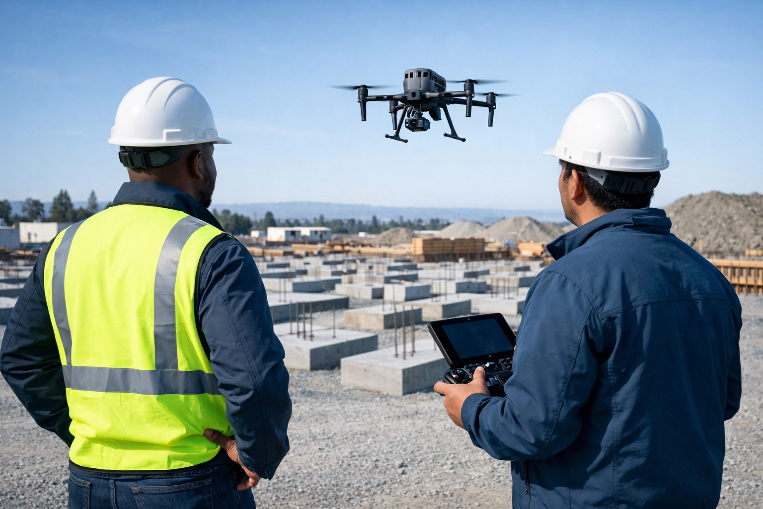
Drone mapping has changed the speed equation for project oversight. Industry reporting has shown aerial data capture can be roughly 60x faster than manual methods: mapping approximately 120 acres per hour compared to just 5 acres per hour using traditional ground methods. This speed is not just a convenience; it is a financial safeguard. It means errors are found while they’re still cheap to fix, not after crews and materials have already stacked up behind them.
The traditional method of identifying errors on a construction site is often reactive. A superintendent notices a discrepancy during a walk-through, or a subcontractor realizes a utility line is not where it was supposed to be after the concrete has already been poured. At this stage, the damage is already done. The cost of breaking up concrete, rerouting utilities, and rescheduling trades creates a "ripple effect" of delays that can push a completion date back by weeks. When schedules slip, liquidated damages start to accrue, and the overhead of maintaining a site: cranes, trailers, and personnel: eats into the remaining profit.
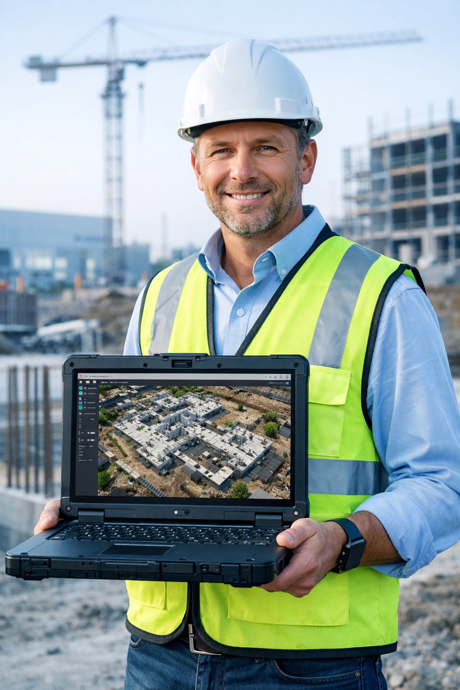
Precision aerial imaging transforms this reactive environment into a proactive one. Through the use of high-resolution orthomosaics: stitched-together aerial images that are georeferenced to provide survey-grade accuracy: teams can overlay their CAD designs directly onto the current site conditions. This "design vs. reality" comparison allows project managers to catch a foundation that is six inches out of alignment or a trench that is incorrectly graded before it causes a major conflict.
In the Chattanooga area, where terrain can be challenging and site footprints are often tight, having this visual overlay is a game-changer. It provides a "single source of truth" that all stakeholders: from the owner to the subcontractors: can access. By identifying these discrepancies early, construction drone services provide a safety net for the project budget. For more details on how these digital tools prevent financial leakage, you can explore the ROI of precision and how digital twins cut construction rework.
Furthermore, the "wait and see" approach often leads to disputes between trades. When a delay occurs, the finger-pointing begins. Was the site not ready for the plumber? Was the electrical layout incorrect? With weekly or bi-weekly orthomosaic updates, you have a chronological, visual record of the site. This objective documentation settles disputes quickly because the data does not lie. It shows exactly what the site looked like on Tuesday at 10:00 AM, allowing project managers to move past the blame game and back to the building process.
Eliminating Earthwork Guesswork with Cut/Fill Data
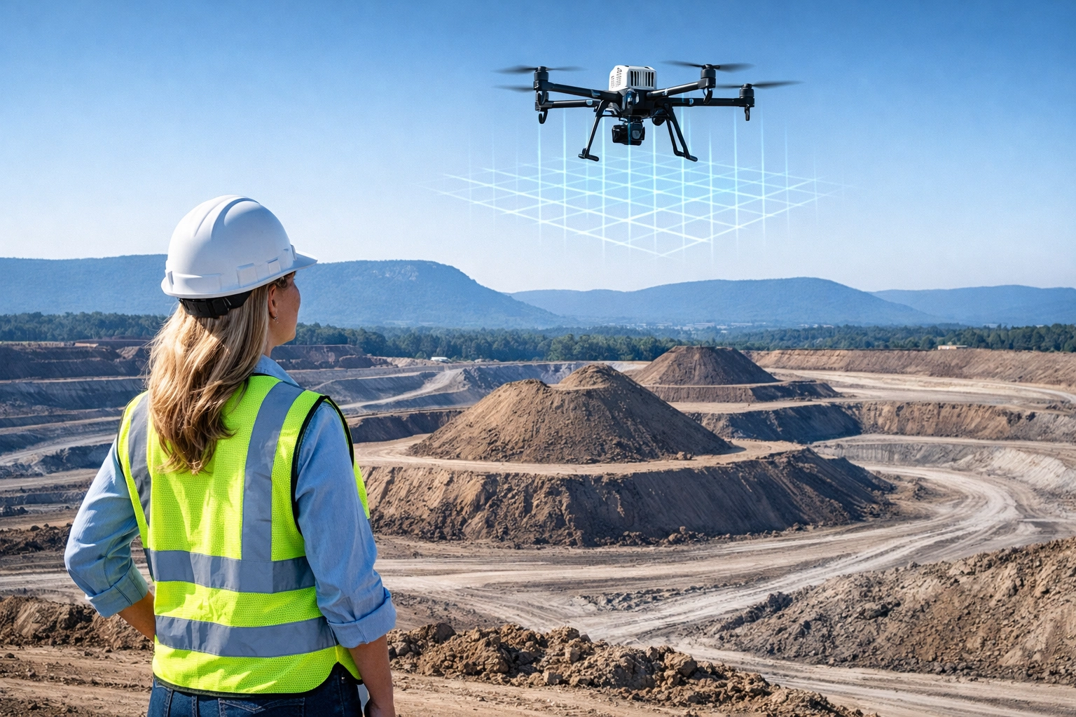
One of the most significant variables in any construction budget is earthwork. Excavation and grading are notorious for "budget creep," often because traditional surveying of large stockpiles and shifting terrain is time-consuming and prone to human error. When a contractor relies on "eyeballing" a stockpile or using sparse GPS points, the resulting estimates for how much dirt needs to be moved or brought in can be off by significant margins. In a large-scale project, being off by even 10% on a volumetric estimate can equate to tens of thousands of dollars in unexpected trucking and material costs.
Cut/fill drone measurement has revolutionized this aspect of the industry. Using photogrammetry or LiDAR, a drone can capture millions of data points across a site in a fraction of the time it takes a ground crew to walk the same area. This data creates a 3D volumetric model of the site, allowing for incredibly accurate calculations of "cut" (soil to be removed) and "fill" (soil to be added). In practical terms, teams have used drone-driven workflows to cut surveying expenses by 70% to 90%.
For contractors working with Blue Nose Aerial Imaging of Chattanooga, this capability translates into three distinct competitive advantages:
- Precise Material Forecasting: Knowing exactly how many cubic yards of soil are on-site allows for better logistics. You can determine exactly how many truckloads are required, preventing the common mistake of over-ordering fill or paying for the disposal of excess soil that could have been used elsewhere on the project.
- Subcontractor Accountability: Earthwork is often one of the first major expenses on a project. When an excavation subcontractor claims they moved 10,000 cubic yards of material, project managers no longer have to take their word for it. You can verify that claim with a timestamped, survey-grade report. This level of transparency ensures that you only pay for the work that was actually performed.
- Budget Protection and Risk Mitigation: Grading issues can lead to poor drainage and long-term structural problems. Accurate 3D models allow engineers to verify that the site is being graded to the exact specifications of the plan. Catching a grading error during the rough-cut phase is simple; fixing it after the asphalt is laid is a nightmare.
The integration of LiDAR technology has further enhanced these capabilities, especially on sites with heavy vegetation or complex topography. While standard photogrammetry is excellent for open sites, LiDAR can "see" through tree canopies to provide a true ground surface model. This is particularly relevant for new developments in the wooded areas surrounding Chattanooga, where clearing and grubbing costs can be difficult to estimate without high-accuracy terrain data.
If you are new to this technology or looking to refine your site planning, check out our Drone Volume Measurement 101 guide to understand how these measurements protect your bottom line. By removing the guesswork from the earthwork phase, you set a foundation of precision that carries through the entire lifecycle of the project.
Looking Ahead: Part 2
While precision mapping and earthwork data are the foundation of cost savings, they are only part of the story. In Part 2 of this series, we will dive into how aerial imaging streamlines the daily and weekly workflows of a busy jobsite. We will explore the power of weekly progress monitoring, the seamless integration of drone data into platforms like Procore and BIM, and how high-resolution visuals are significantly reducing jobsite liability and safety risks.
Stay tuned to learn how to turn your aerial data into a fully integrated project management powerhouse. In the meantime, if you're ready to see how these tools can be applied to your current project, feel free to contact us for a consultation.